
Overview
- 內容
History
The establishment of this office has its origin in 1916 with the construction of the Taoyuan Canal Irrigation System. The water was taken from Shimen area on the upper course of the Dahan River which flows through 20 km of waterways and 25 km of main canals to irrigate the 22,000 hectares of farmland on the Taoyuan Plateau, transforming this barren and water-deficient plateau into fertile double crop rice paddy fields. The Taoyuan Canal maximum water diversion volume was 16.70 cubic meters per second, and it was inaugurated on May 26, 1924.
In 1919, the predecessor of this office, the public Taoyuan Canal Water Conservancy Association was established in order to assist farmers in the construction of reservoirs and water supply canals in the Taoyuan Canal irrigation system. The said association completed 132 river weirs and 231 reservoirs for the Taoyuan Canal Irrigation System, with a total area of 2,218 hectares, a total water storage capacity of 66 million cubic meters, and the completion of 846.5 kilometers of water supply canals. All the above-mentioned projects were completed by 1928.
In 1930, it was reorganized into Taoyuan Water Conservancy Association in accordance with the Taiwan Water Conservancy Association Decree.
In 1945, it was reorganized again into the Taoyuan Farmland Water Conservancy Association.
Reorganized into Taoyuan Water Conservancy Commission in 1948.
In 1950, it was renamed Taoyuan Canal Water Conservancy Commission.
In 1956, the Daxi Water Conservancy Commission and the Hukou Water Conservancy Management Office were merged in and reorganized into the Taoyuan Irrigation Association of Taiwan Province.
Merged with Xinhai Irrigation Association in 1970, the name of Taoyuan Irrigation Association of Taiwan Province was continued. After the merger, the irrigated area reached 34,568 hectares.
Due to urban and industrial development, farmland area has been steadily decreasing. In 2017, the irrigated area has dwindled to 22,677 hectares.
On October 1, 2020, it was restructured into Taoyuan Management Office, Irrigation Agency, Council of Agriculture, Executive Yuan.
On August 1, 2023, it was restructured into the present-day Taoyuan Management Office, Irrigation Agency, Ministry of Agriculture.
Natural environment
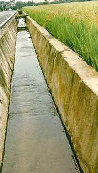 The irrigation area administered by this office is located in the northwest part of Taiwan, namely Taoyuan and Zhongli in Taoyuan County. It is commonly known as the Taoyuan Plateau, which slopes from southeast to northwest and borders the natural environment of the Taiwan Strait. From the high terrain in the southeast, it stretches towards the northwest coast in a 1:100 gradient slope. The rivers in this area are short in length, and the rainwater retaining time is quite brief, thus usable water sources are limited. It has always been a dry field and cultivation is in the power of the weather. Ponds are usually built along the sloping undulations of the plateau to collect rainwater for irrigation. Therefore, the arable land area on the plateau at that time was approximately 27,000 hectares, but the ponds covered an area of more than 8,000 hectares, and are found in different sizes scattered around the area in more than 10,000 locations, which is comparable to the stars in the sky and can be seen everywhere, becoming the characteristics of this area. However, water used for irrigation is still insufficient to achieve the goal of second cropping due to the influence of climate and rainfall. In the unfortunate scenario of a long drought, the farmers are always anguished to find the water source depleted, the crop withered, and the dry pond cracked. Consequently, some of the rice paddy fields are used for planting sweet potatoes and tea trees, or even abandoned. Therefore, local farmers are in pressing need of water conservancy infrastructures that can provide stable water sources.
According to Taiwan's agricultural climate division, this area is located in the northern part of Taiwan and presents a hot and humid subtropical climate with an average temperature of 21 ℃, which is suitable for crop growth throughout the year. Summers are long with an average of 27.6 ℃, while winters are short with an average of only 15 ℃. According to statistics, the average annual precipitation is about 2,000 mm. Although the seasonal distribution of rainfall is typically higher in summer, winter is still not overly dry. The rice growth period in this region is from February to October every year. During this 9-month period, the effective rainfall utilization rate is about 20% or more.
Clay loam is predominant in this region, with 39%. It has the highest proportion of soil, followed by sandy loam with 26%, while light clay accounted for about 18.6%, and sandy clay loam the least, accounting for only 16.4%.
Irrigation area
The administrative irrigation area of this office is within the scope of Taoyuan Canal’s single canal irrigation system. Since the Guangfu Canal at the end of Taoyuan Canal and most canals below Shimen are all irrigation systems that draw water from Dahan River, the government decided to carry out integration of these irrigation systems starting with the merger of two irrigation areas, Daxi and Hukou in 1956. Later in 1970, the 5,176 hectares of irrigation area belonging to the Xinhai Irrigation Association was annexed into this office’s administrative jurisdiction. The integration has expanded this office’s administrative area, which covers 25 administrative districts including Taoyuan City, New Taipei City and Hsinchu County, with an irrigated area that has increased to 34,568 hectares. During the implementation of the Farmland Water Conservancy Association Improvement Plan from 1975 to 1982, the irrigated area was 31,056 hectares. However, due to increasing population, industrial and commercial development, and the changes in social structure, several farmlands in irrigation areas have been converted for other uses, which has reduced the number of cultivated lands. Therefore, according to statistical records, irrigated area was only 28,241 hectares in 1984, 26,235 hectares in 1989, 25,983 hectares in 1995, and 22,677 hectares in 2017.
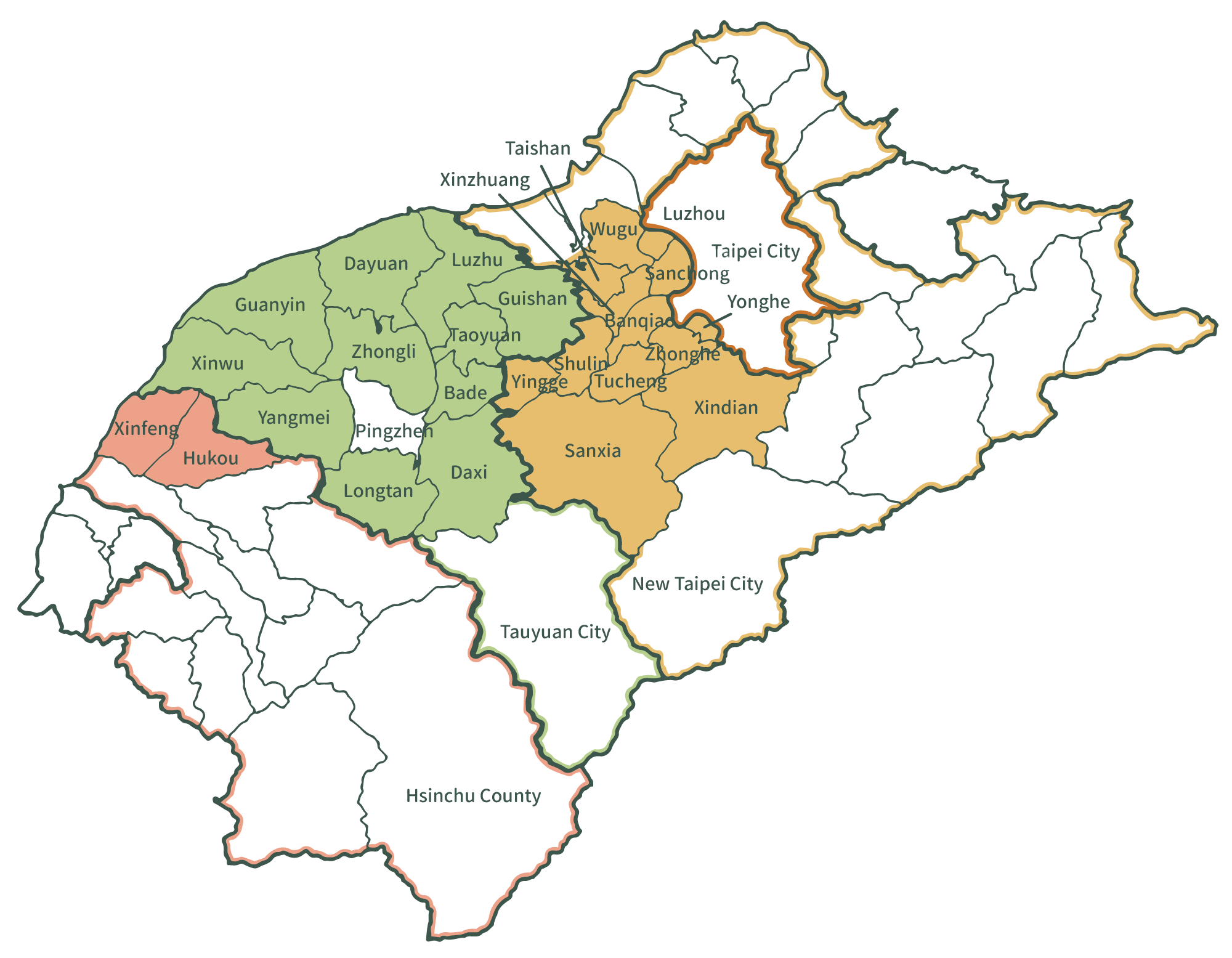
According to terrain and irrigation system, it is divided into 4 main parts:
- Taoyuan Irrigation District
10 administrative districts in Taoyuan City: Taoyuan, Zhongli, Daxi, Bade, Guishan, Luzhu, Guanyin, Xinwu, and Yangmei, with an irrigated area of 21,348 hectares. In 1989 it reduced to 20,192 hectares and became 20,032 hectares in 1995.
- Hukou Irrigation District
Xinwu District and Yangmei District of Taoyuan City, Hukou Township and Xinfeng Township of Hsinchu County, with an irrigated area of 3,834 hectares. In 1989 it reduced to 3,802 hectares, and in 1995 it became 3,801 hectares.
- Daxi Irrigation District
Taoyuan City’s Daxi District and New Taipei City’s Yingge District have an irrigated area of 802 hectares. In 1989 it reduced to 611 hectares, and in 1995 it became 604 hectares.
- Xinhai Irrigation District
New Taipei City's Sanxia, Shulin, Tucheng, Banqiao, Zhonghe, Yonghe, Yingge, Xindian, Sanchong, Xinzhuang, Taishan, Wugu, Luzhou, among other administrative districts, with an irrigated area of 2,239 hectares. In 1989 it reduced to 1,634 hectares, and in 1995 it became 1,546 hectares.
Future outlook
Search new irrigation management systems and irrigation methods to adapt to changes in the agricultural environment and farming types, so as to meet the goals of irrigation, timely drainage and efficient use of water resources, while improving irrigation drainage performance.
Use scientific methods such as computer information operations, geographic information systems and satellite remote sensing to develop modern farmland water conservancy management methods, as well as establish complete and accurate farmland water conservancy and hydrological information data.
Continue to develop farmland water conservancy, improve water resource utilization efficiency, and make further studies and developments on agricultural environmental conservation, water pollution prevention, and rural beautification promotion.